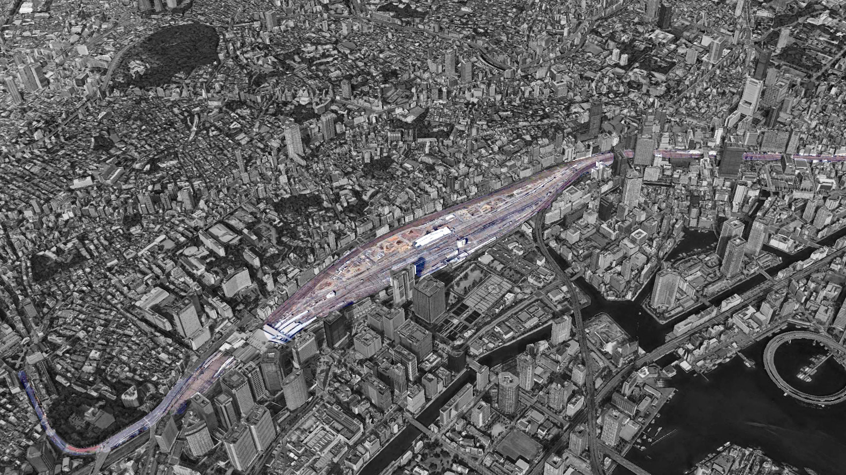
There is huge circular railway "JR Yamanote Line". It divides the central of Tokyo into the inner area and the outer area. In this project, we look at Shinagawa-Tamachi area, where the new station "Takanawa Gateway", designed by Kengo Kuma, would be constructed in 2020 for Tokyo Olympic Games.
We should reconsider this division between bayside area and inner area because a myriad of people will come around here for Olympic. But, it is not only a matter of circulation but also the interpretation of such a huge infrastructure in Tokyo.
The keystone of Tokyo city is always its history and geography. This project aims to reconstruct the image of this area by a feasible method that is led by the detailed research, observation on the site, and its history.
This workshop is too short to grasp all the facts and history. In addition, we are from different countries and universities. So I carefully tried combining and organizing our different merit such as history-based method and form-based method.
Division of the Tokyo city by Yamanote Line
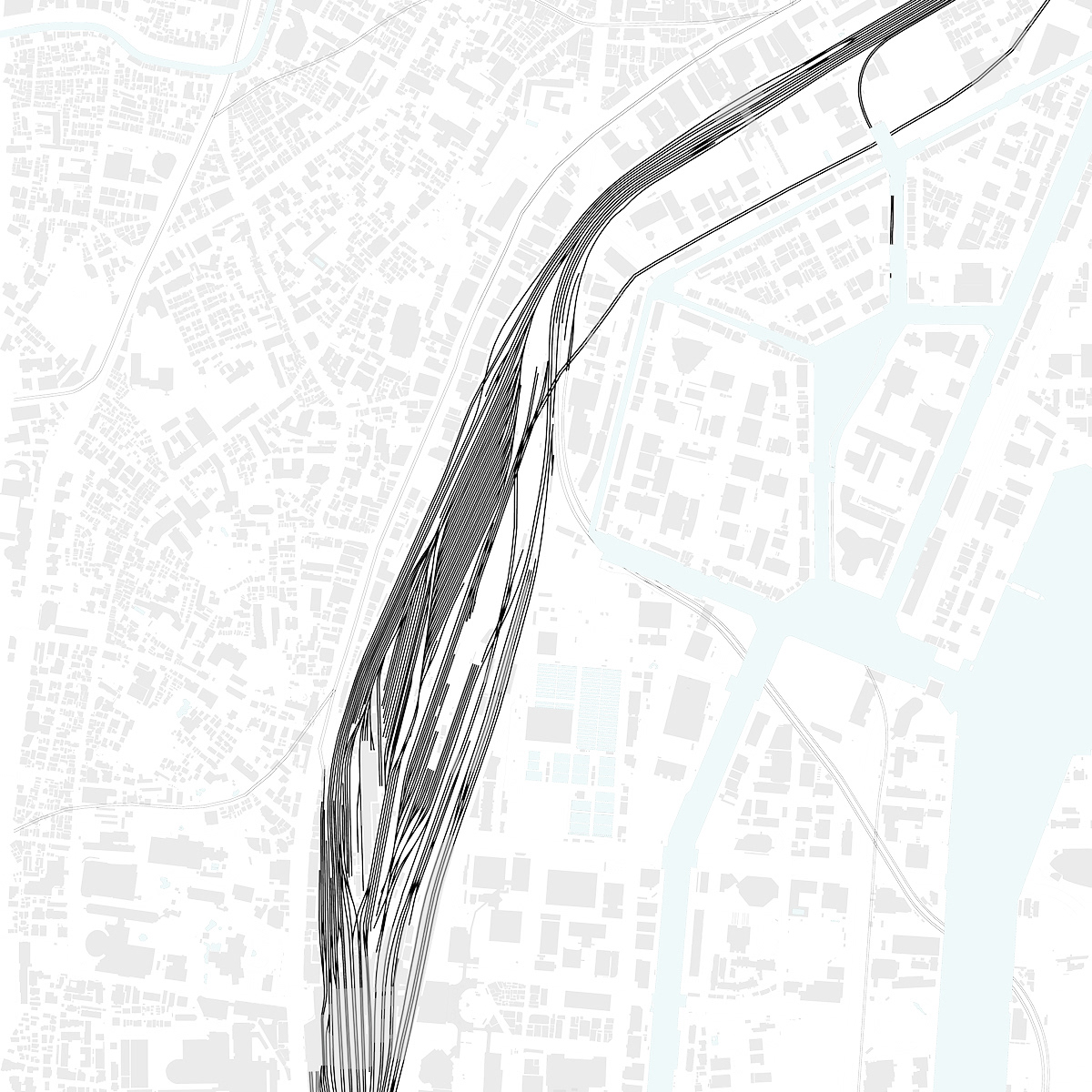
JR Yamanote Line is one of the most important and crucial infrastructure. It greatly contributes the shape of Tokyo. The thing is that Yamanote Line divides the city by its roadway. The division prevents us from cross to the other side, and there is little circulation. However, is the division of the city by Yamanote Line negative? Should we treat with the division?
It seems like community is divided by a river or a mountain. I regard it as the characteristics of Tokyo. Yamanote Line is also affected by the geography when it was constructed. This Line sometimes obeys the geography, and sometimes resist it with cutting. We can say Yamanote Line is a kind of nature of Tokyo city.
Yamanote Railway
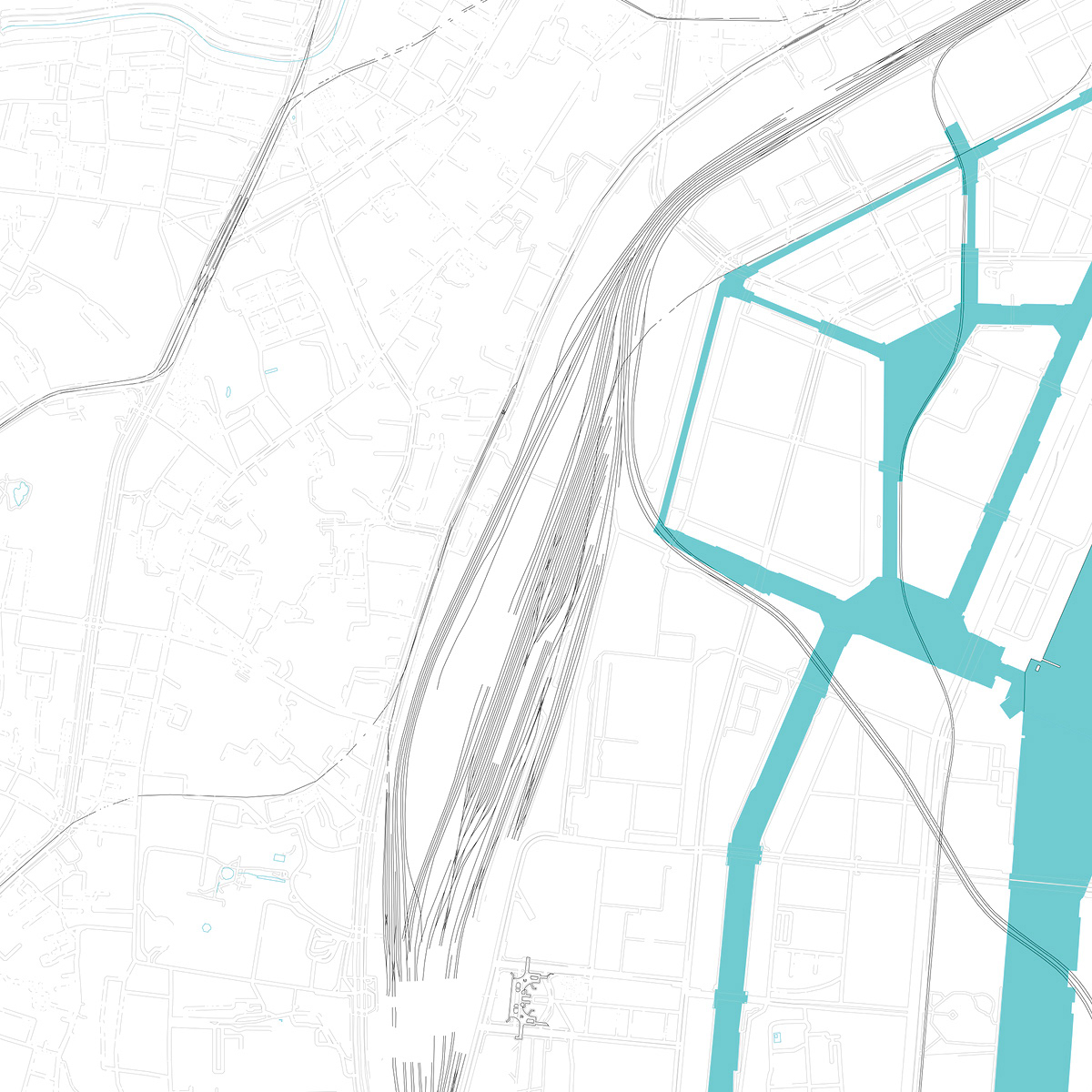
Waterfromt
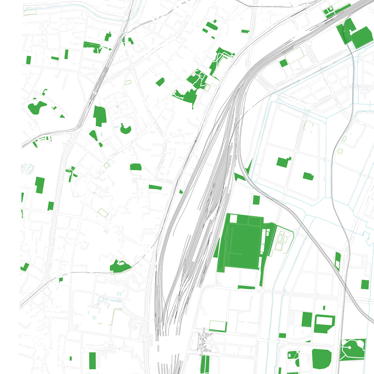
Green Area
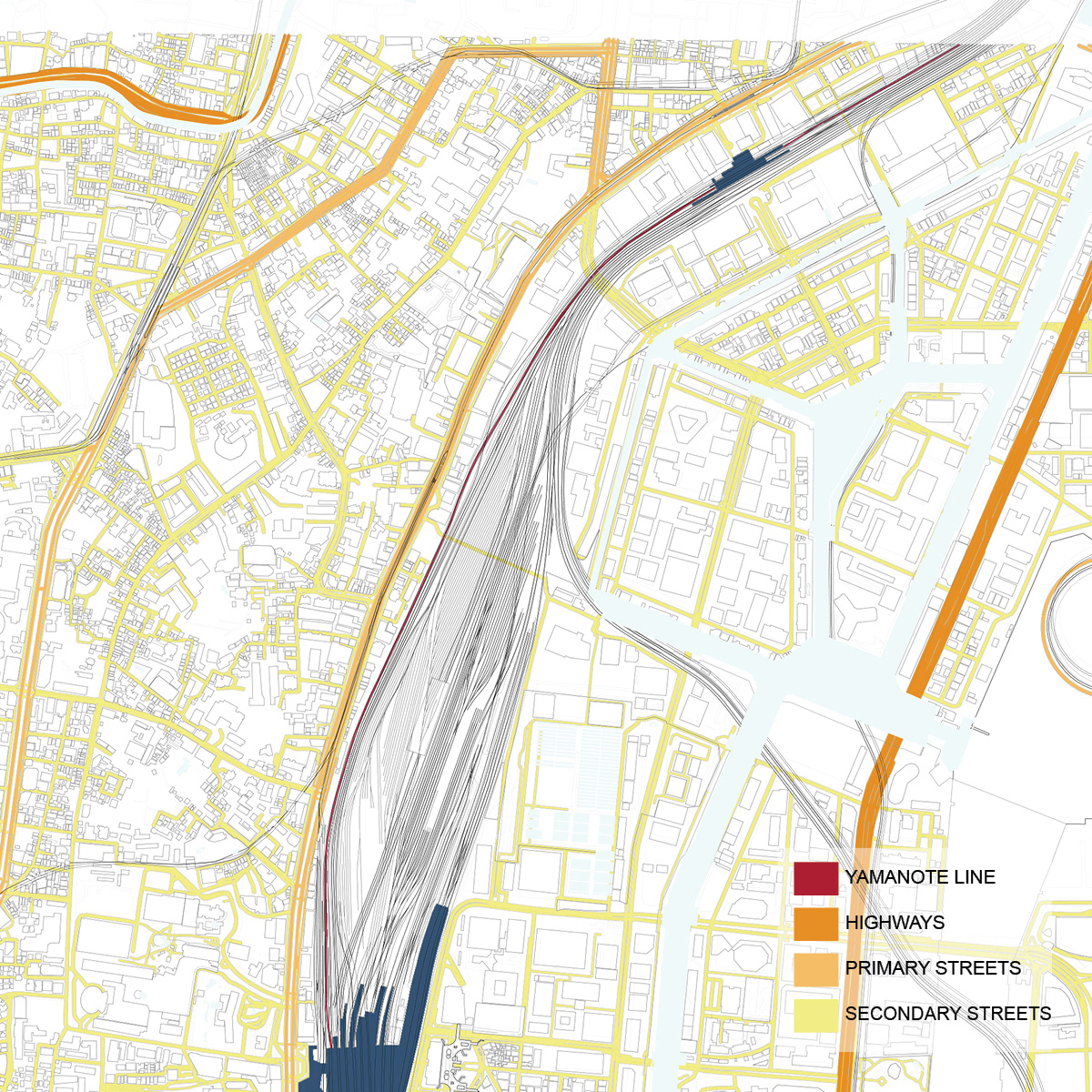
Roadway
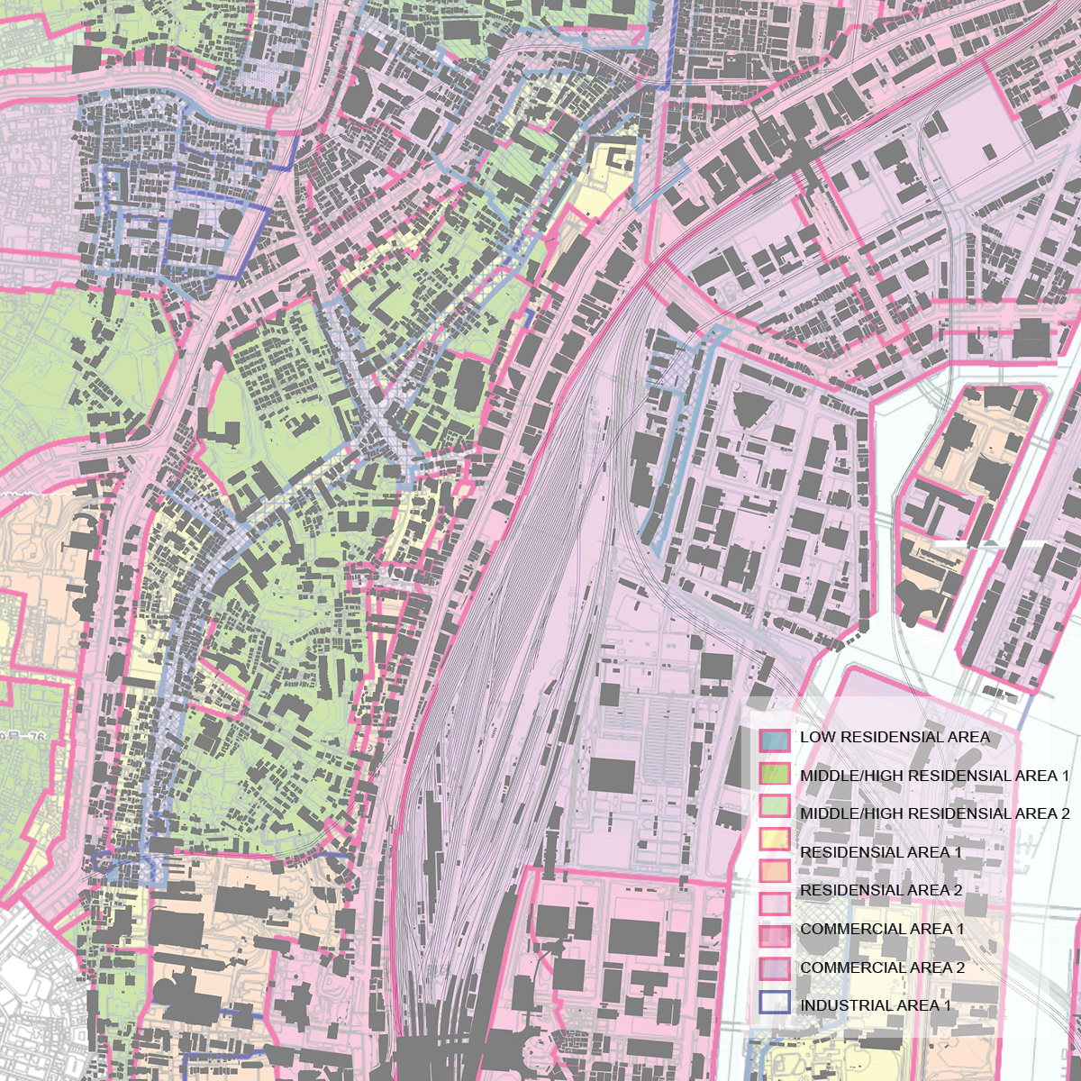
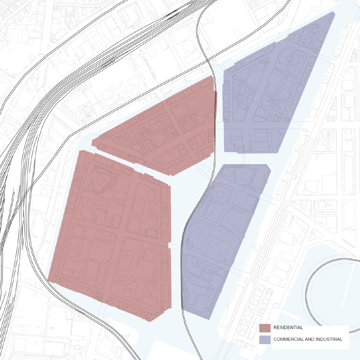
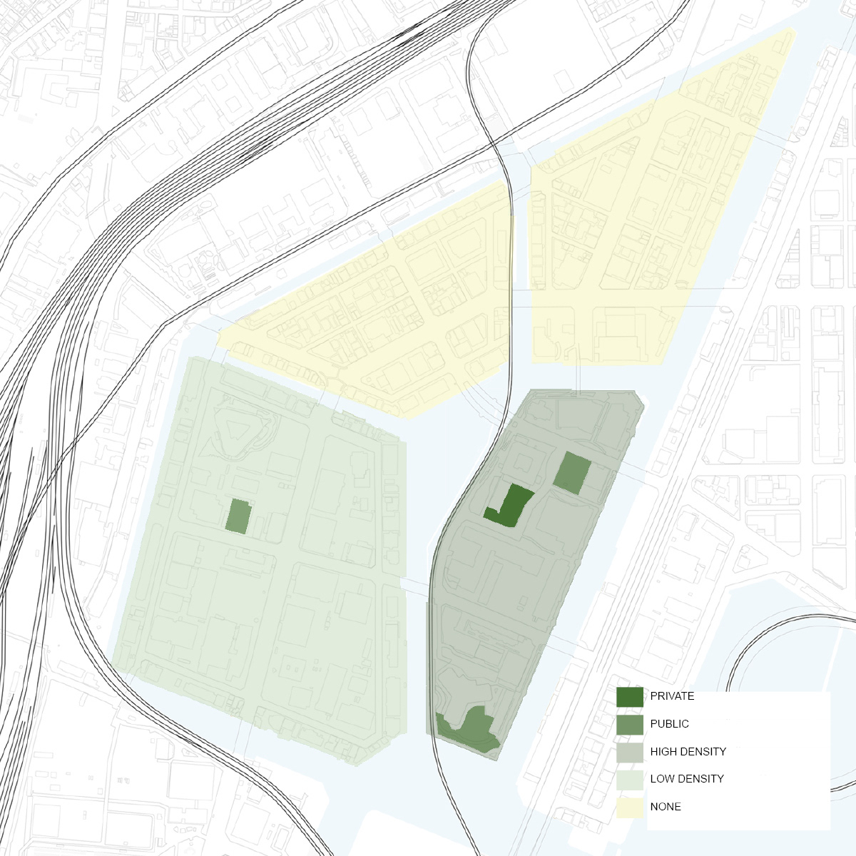
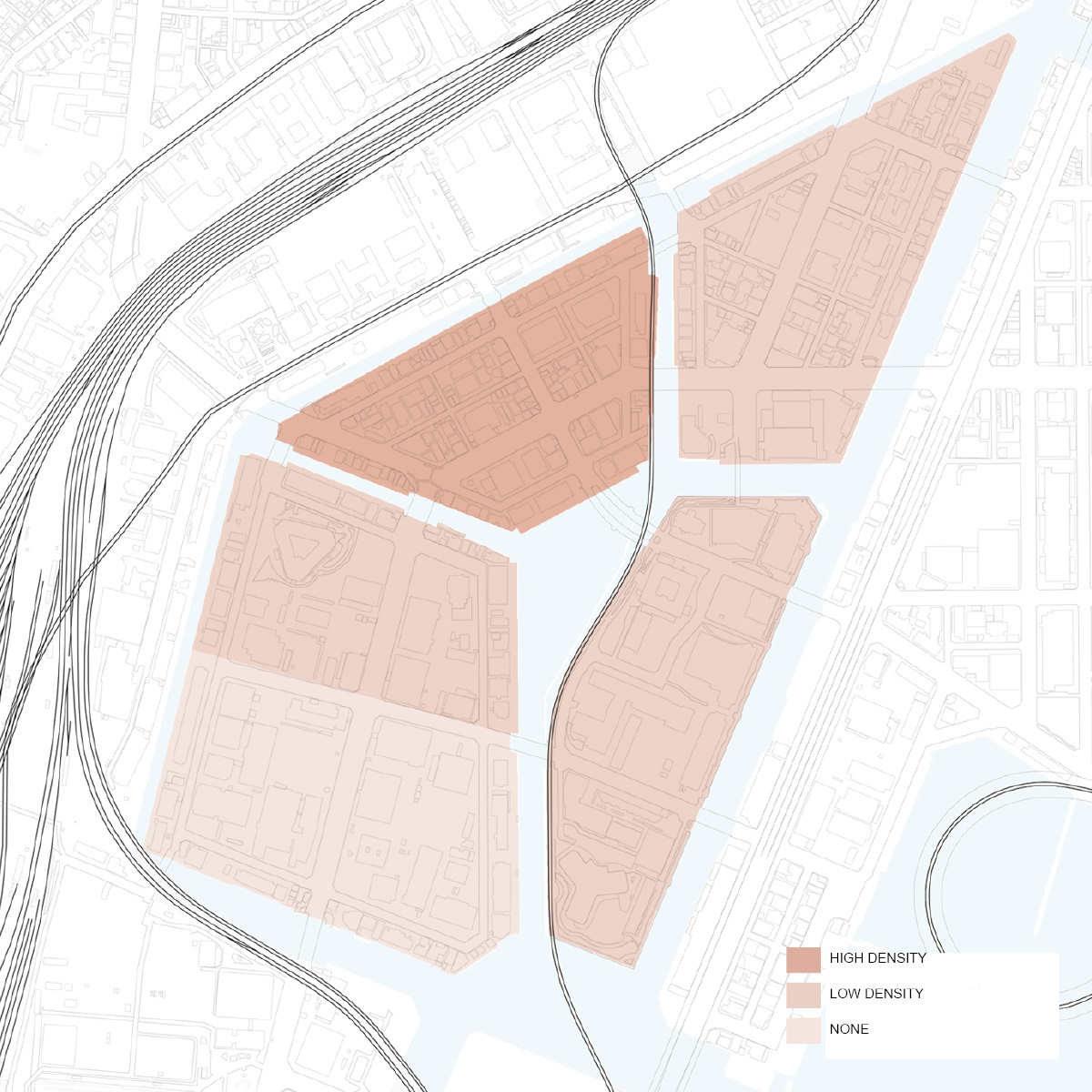
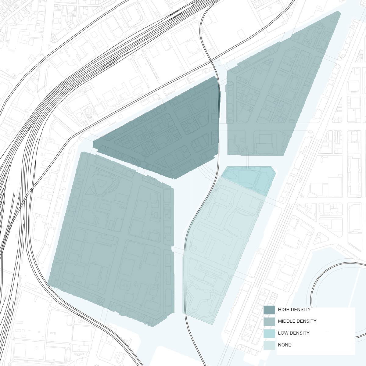
Zoning
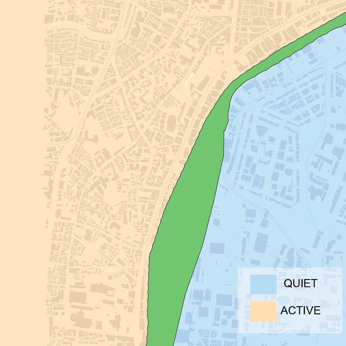
Activity
In Meiji Era
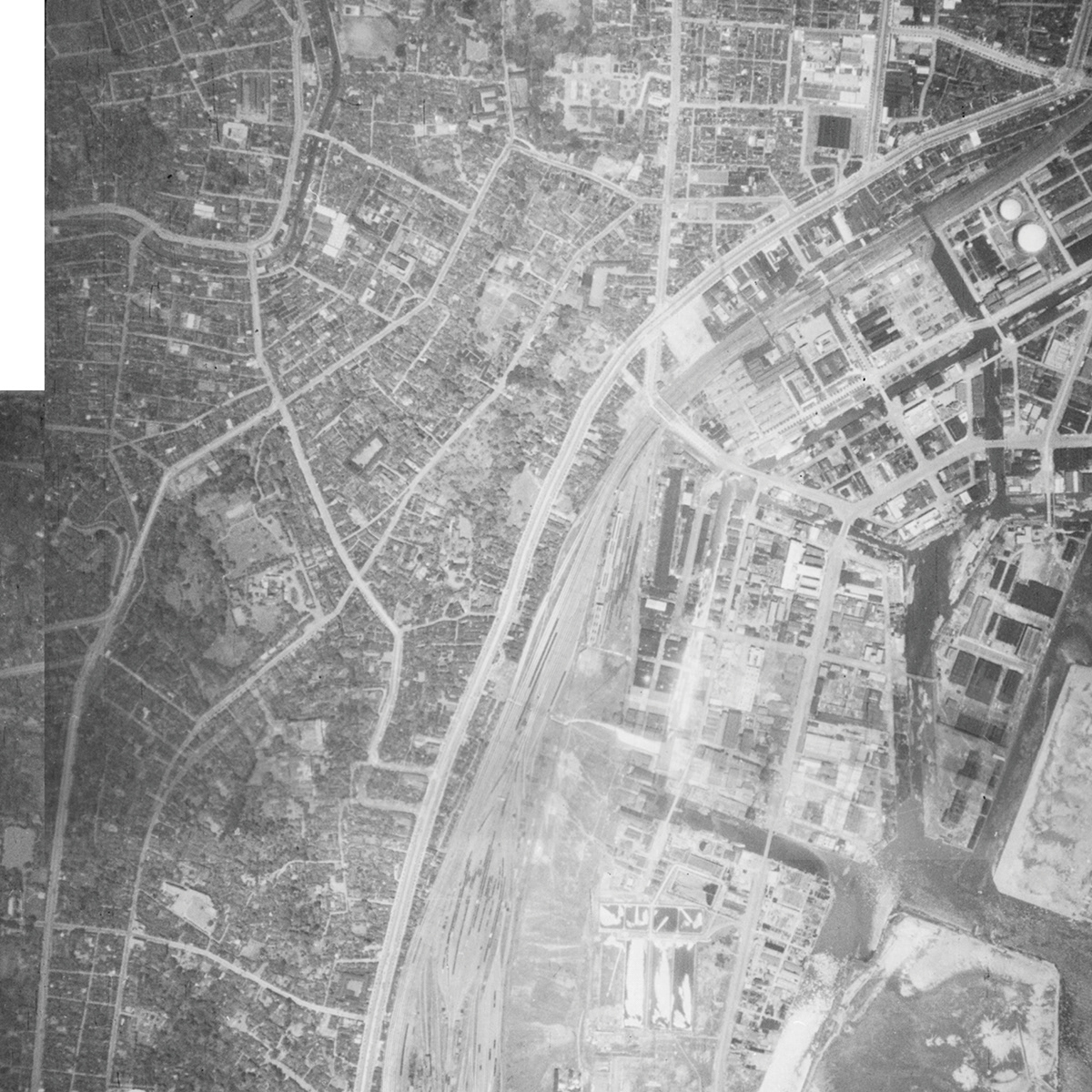
In 1936
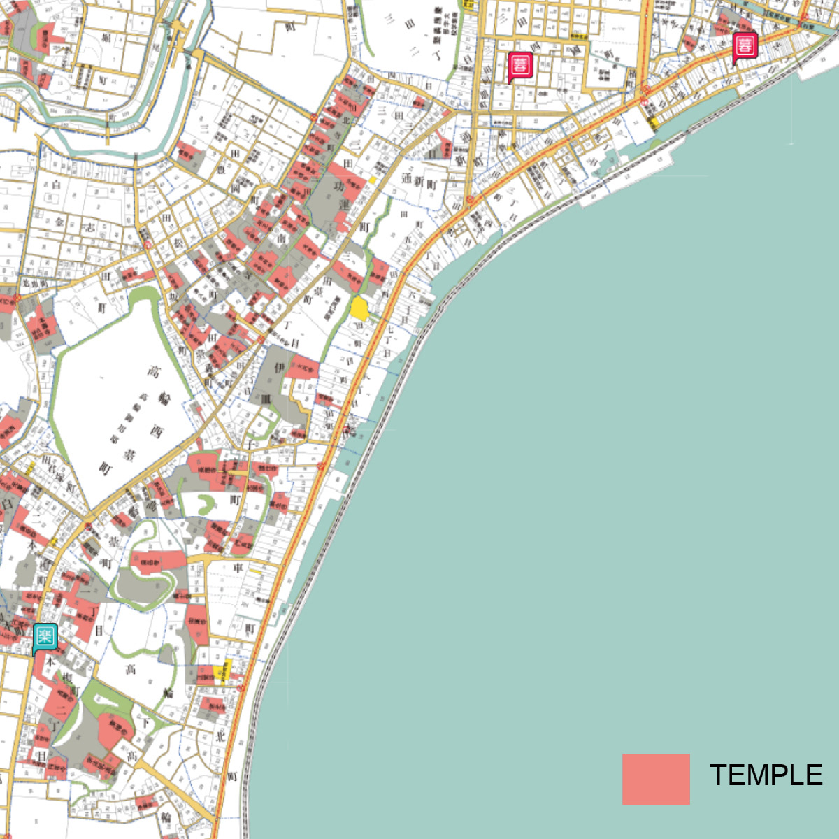
Temples
Temples and Follies
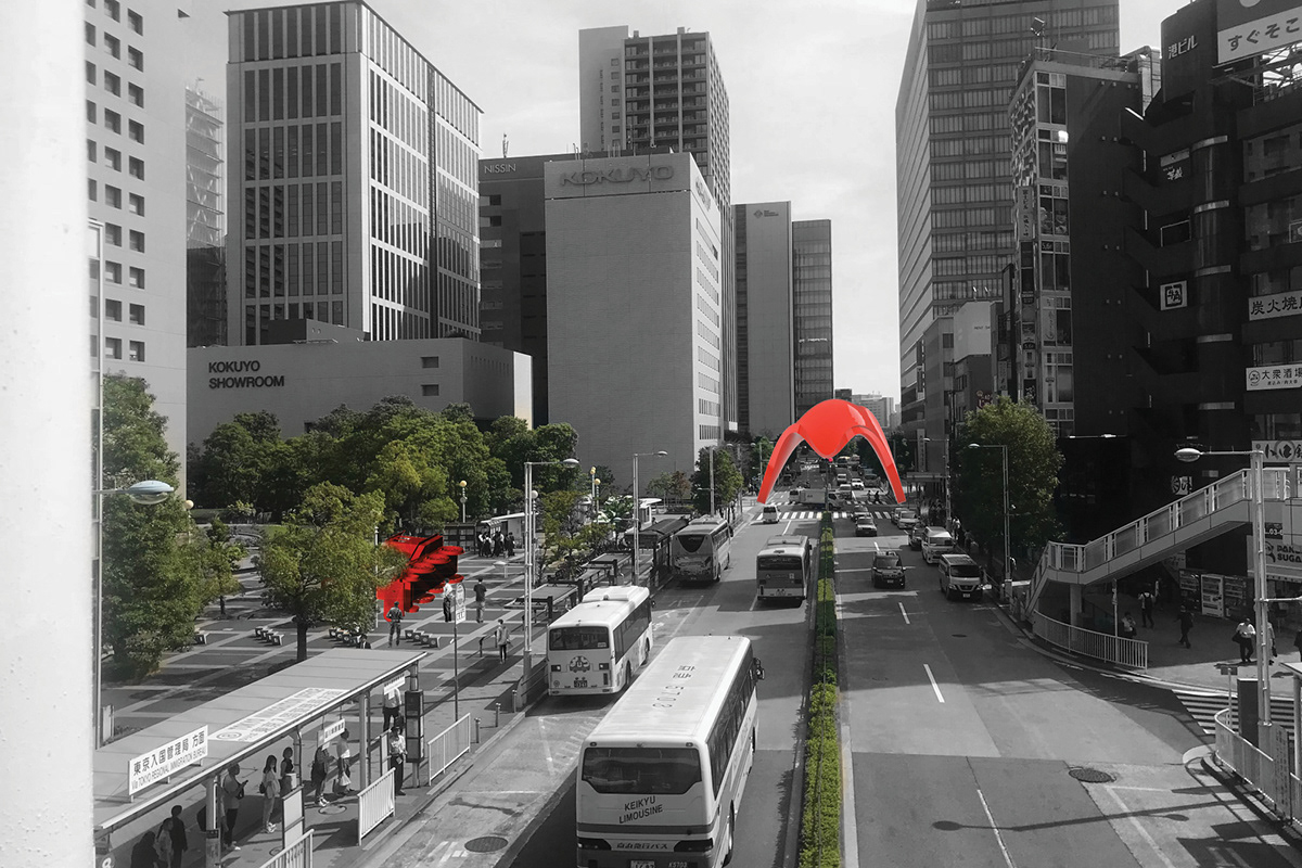
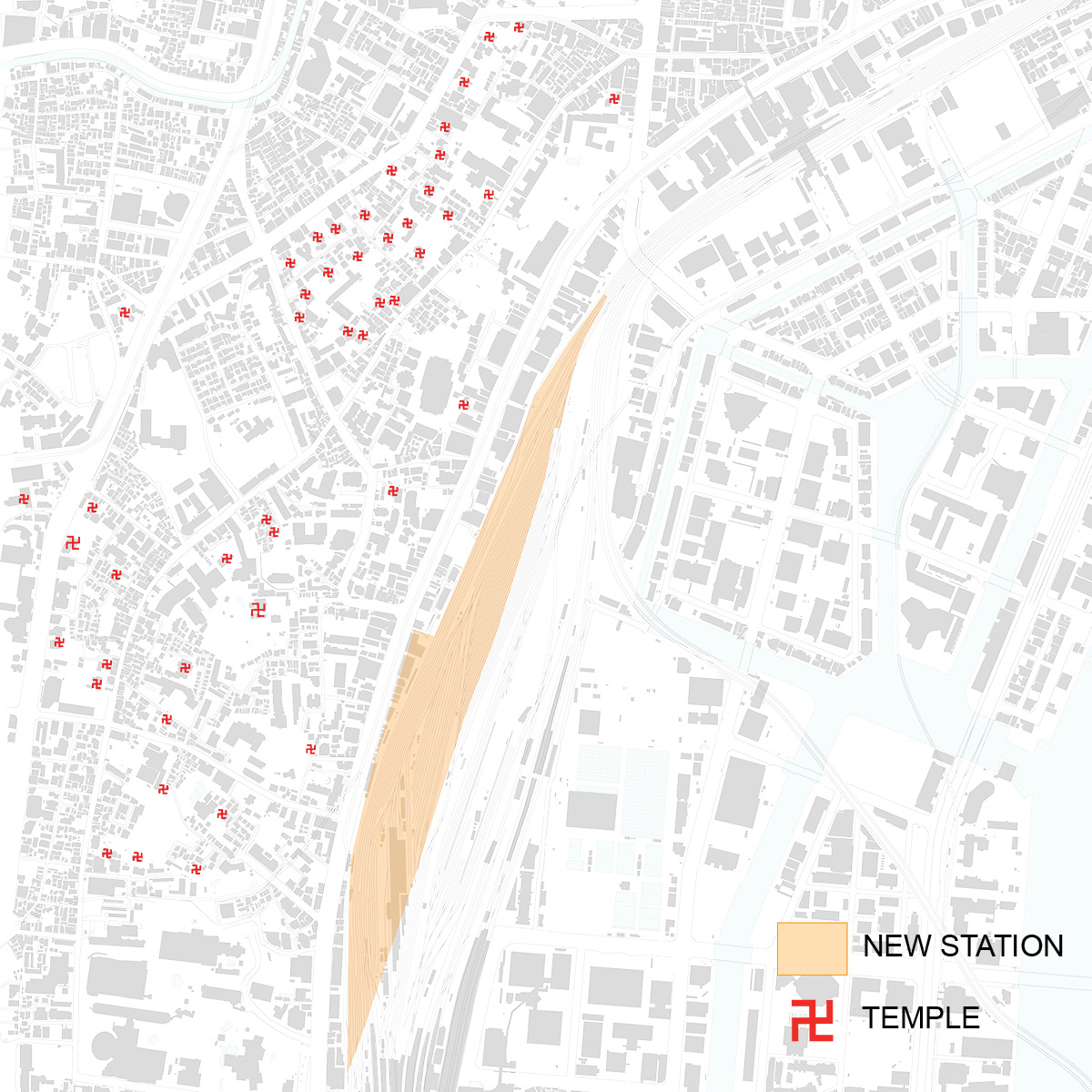
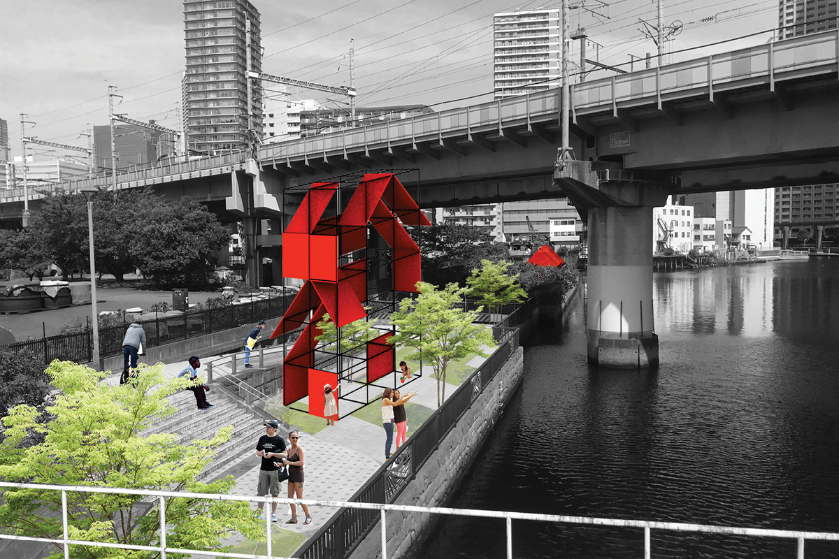
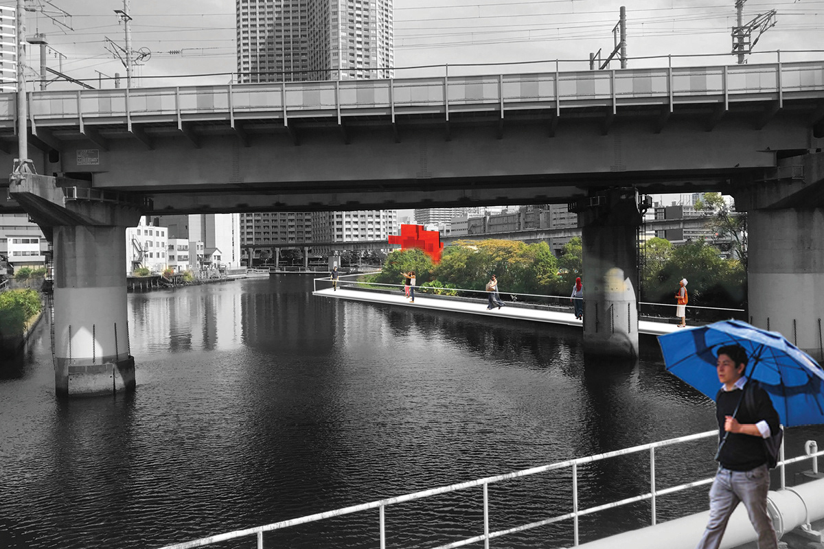
West area was so prosperious as a post-town on the road from Kyoto to Edo that there are a lot of temples in this area. In contrast, east area is a reclaimed land, so there are no temples or historical buildings. New station, Takanawa Gateway, provides circulation between west and east, but the contrast continues to get stronger. This contrast is a product of the history of Tokyo.
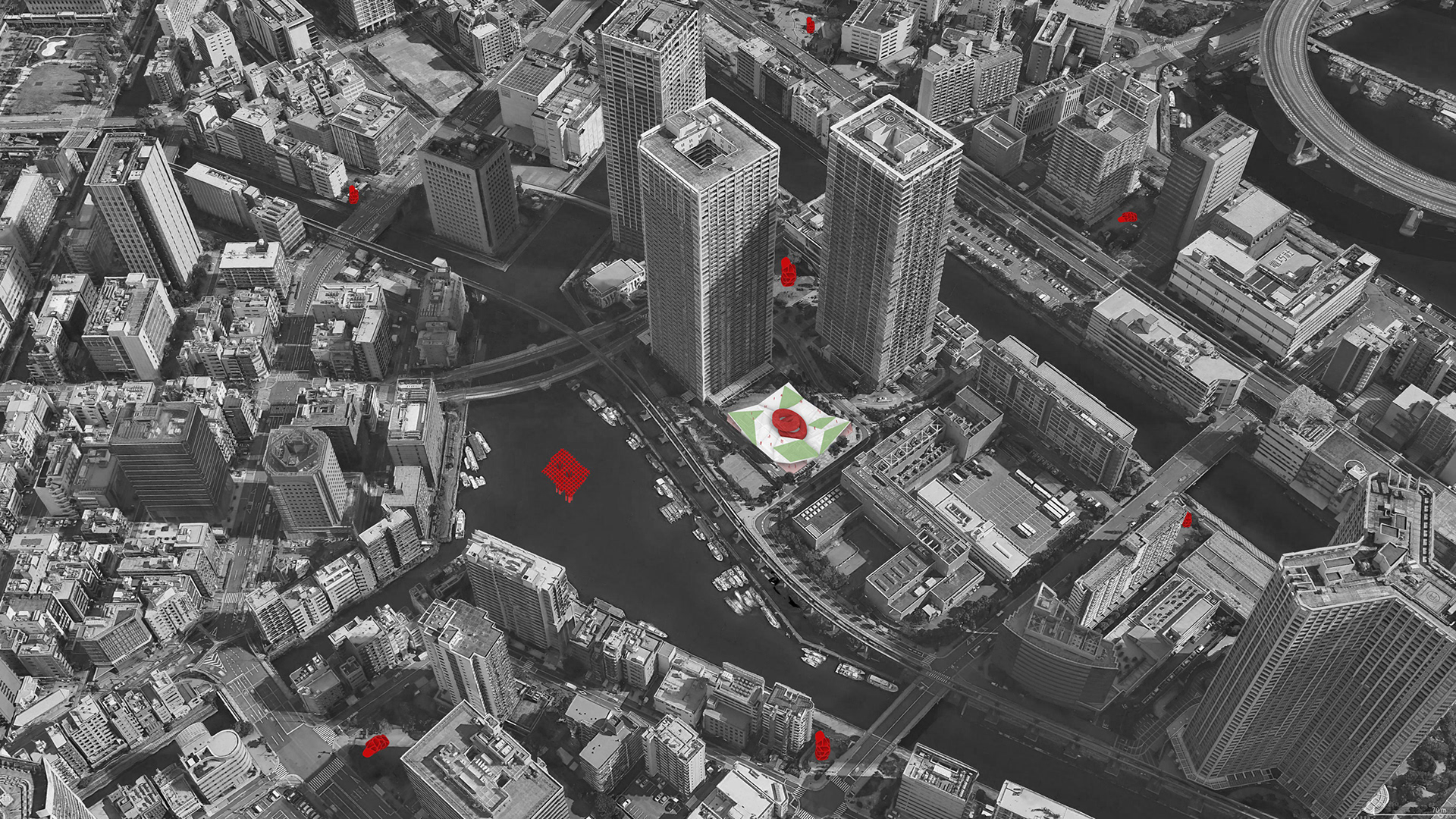
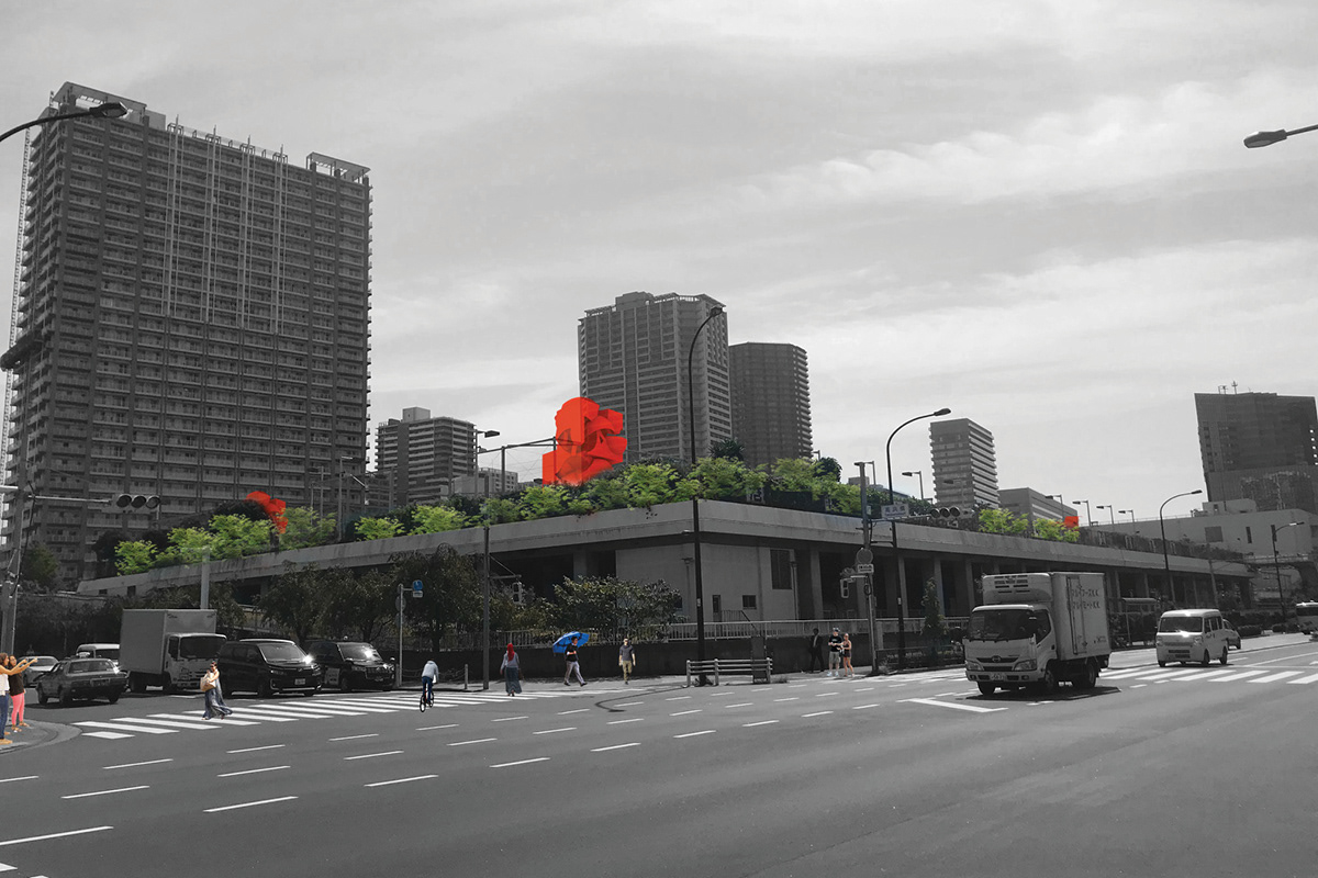
Keeping this constrast, I suggested distribution of temple-like folly in the east area in imitation of Bernard Tschumi's Parc de la Villette. We can see next folly from one folly and walk to there. These follies become landmarks of the city and form loose connection around the area in our minds. The network is easily formed and expands to Olympic Area and the inner area of Yamanote Line.
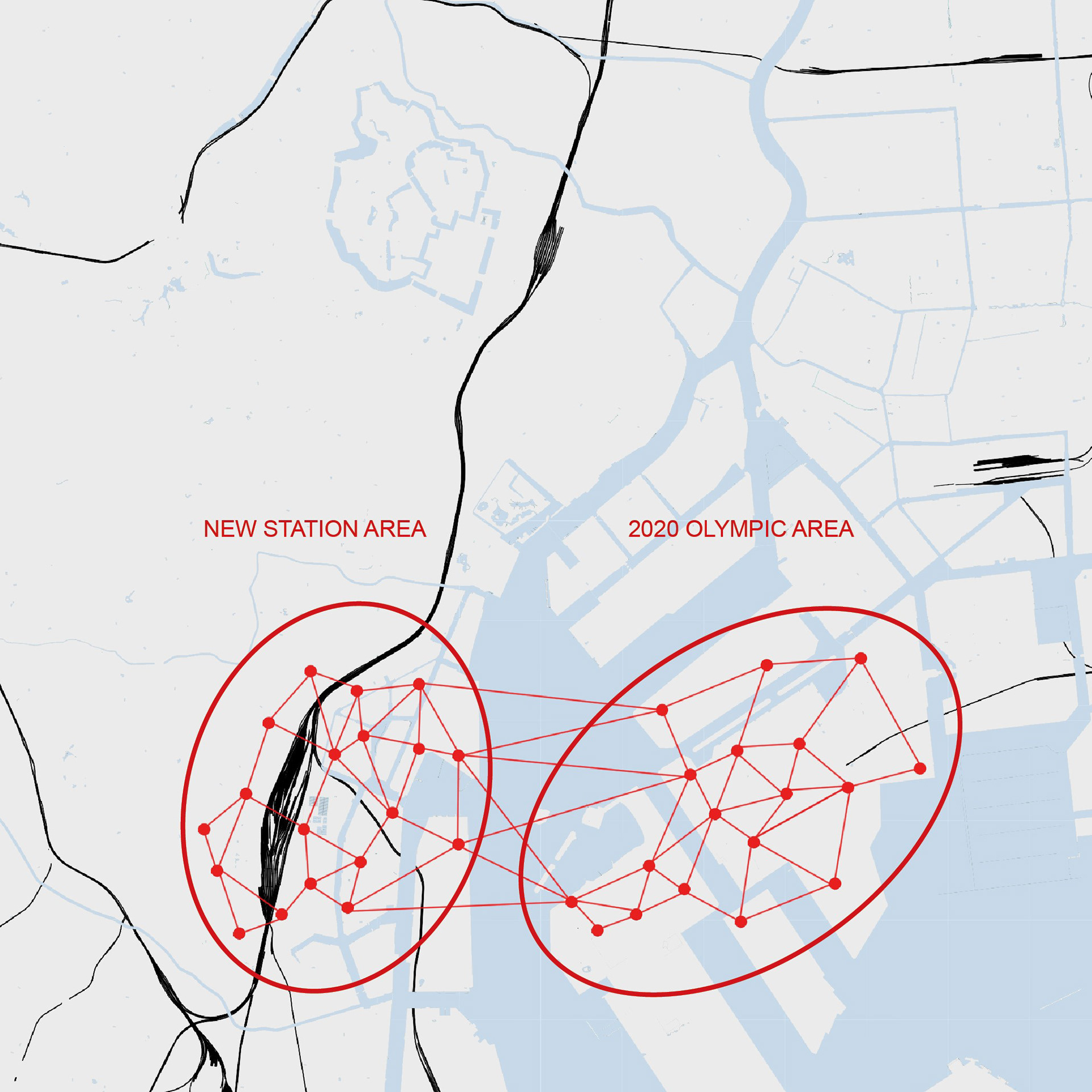
Concept of the network
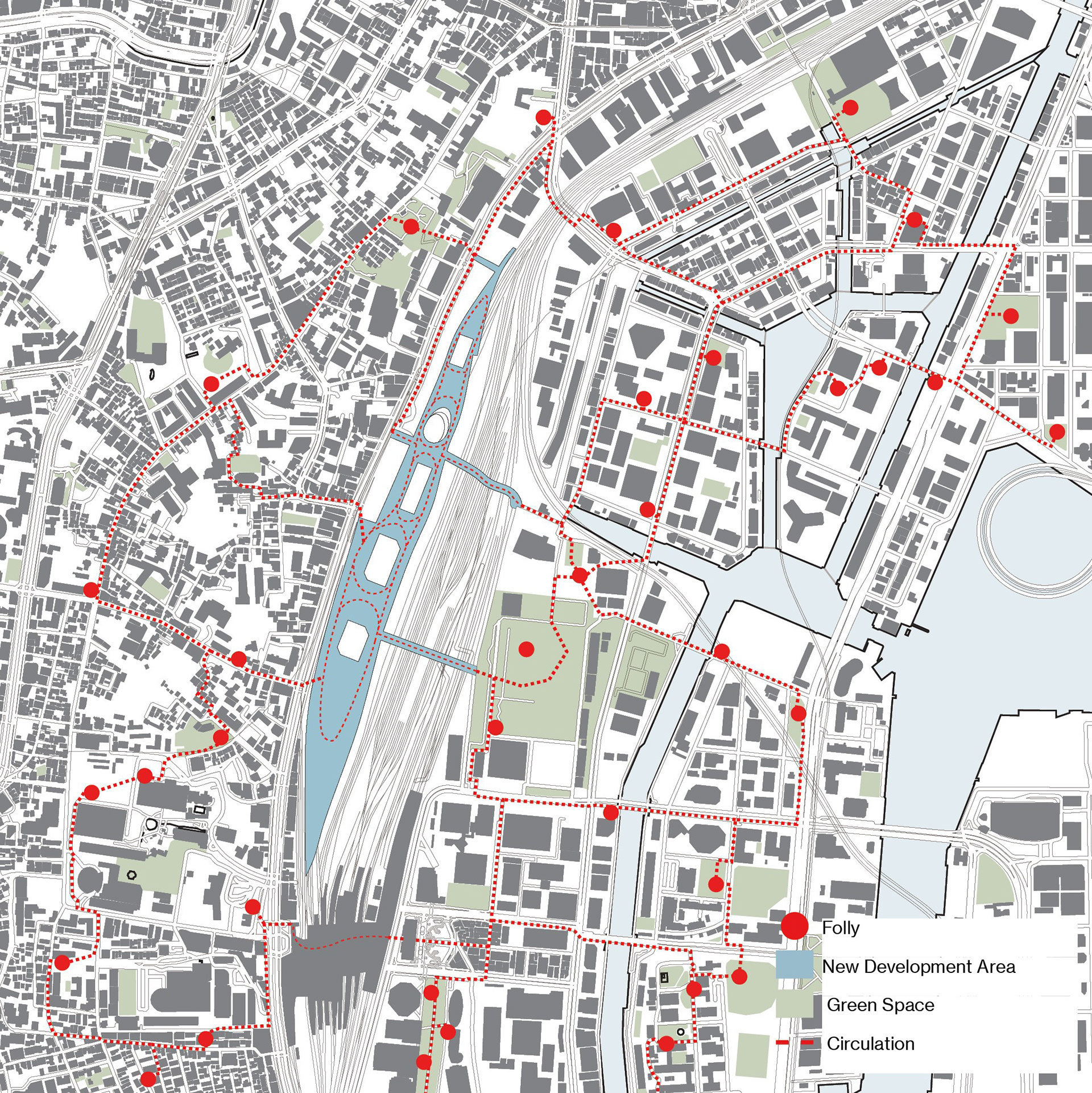
Circulation and Distribution of Follies
General Usage
Green Space
Restaurant
Convenience Stores
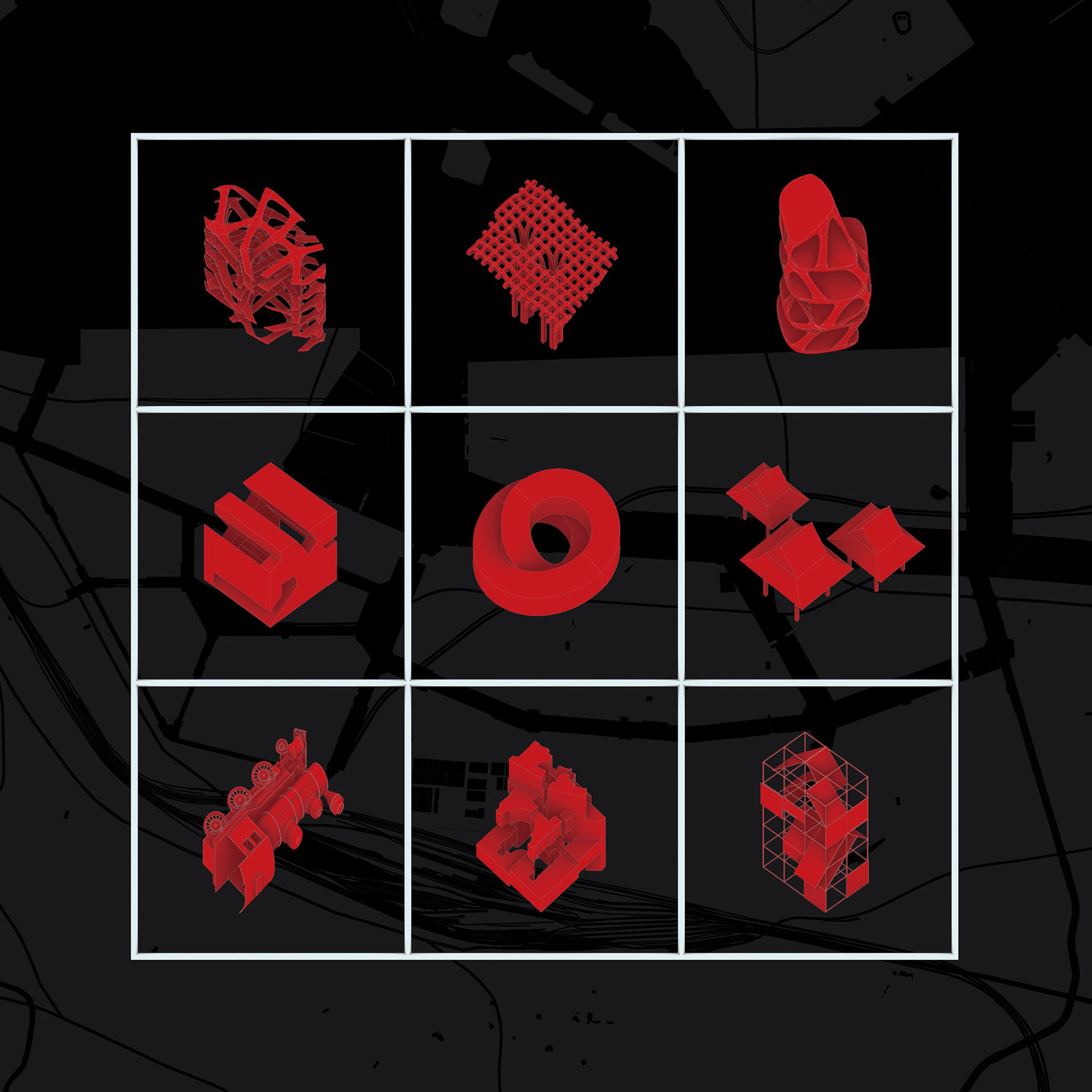
Follies with function
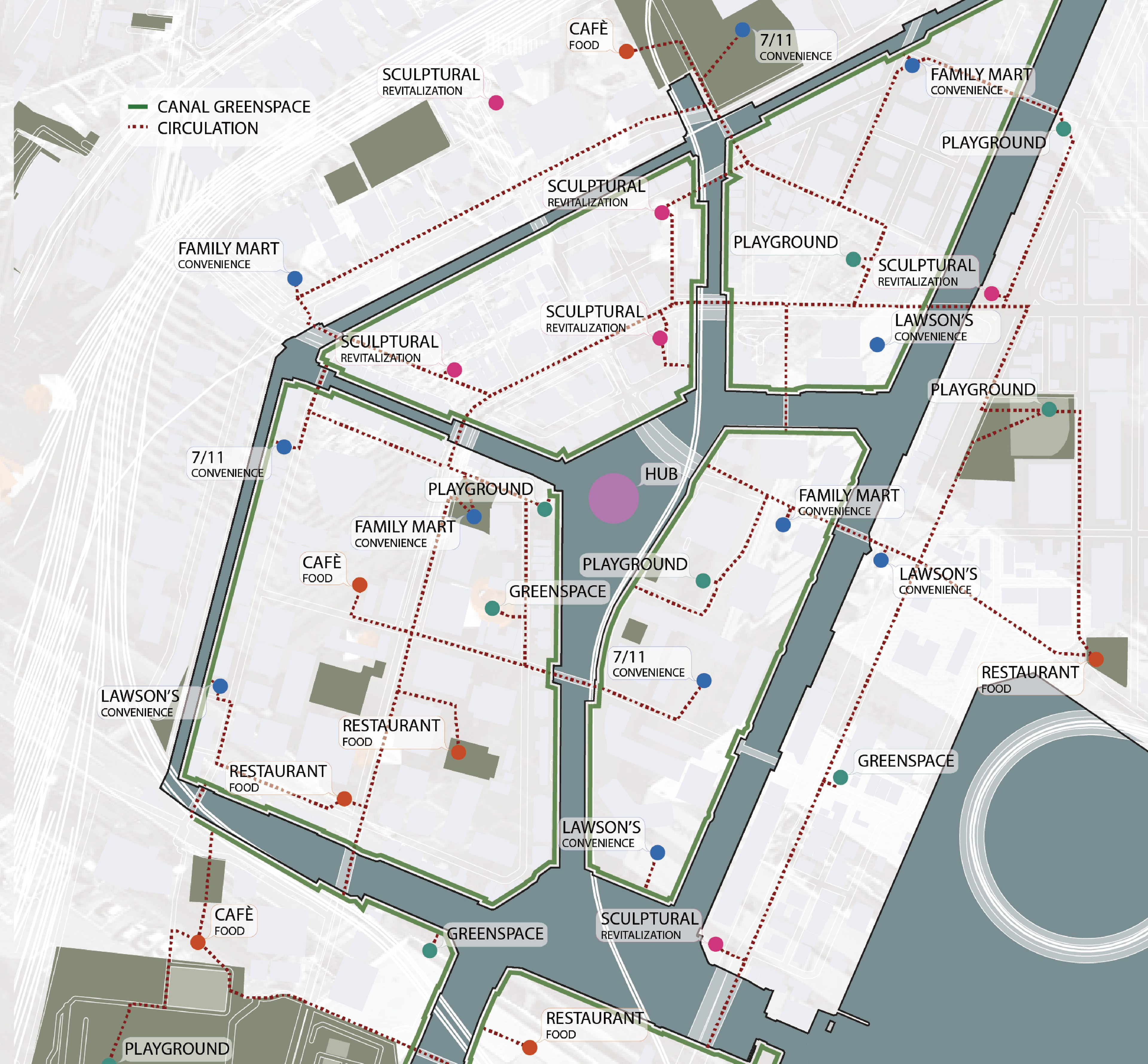
Based on the detailed observation of the closer area, we analyse this area in terms of four points and layout follies. Follies with cafes and shops are placed where has few restaurants and convenience stores. In addition, these areas have little shade. To enhance the confortability, green spaces are also equipped with follies.
The roads cross vertically because reclaimed land is systematically zoned. I take advantage of this good visibility to decide where I put foillies. They contribute a confortable experience and imagine the whole image of these area across Yamanote Line.
Playground
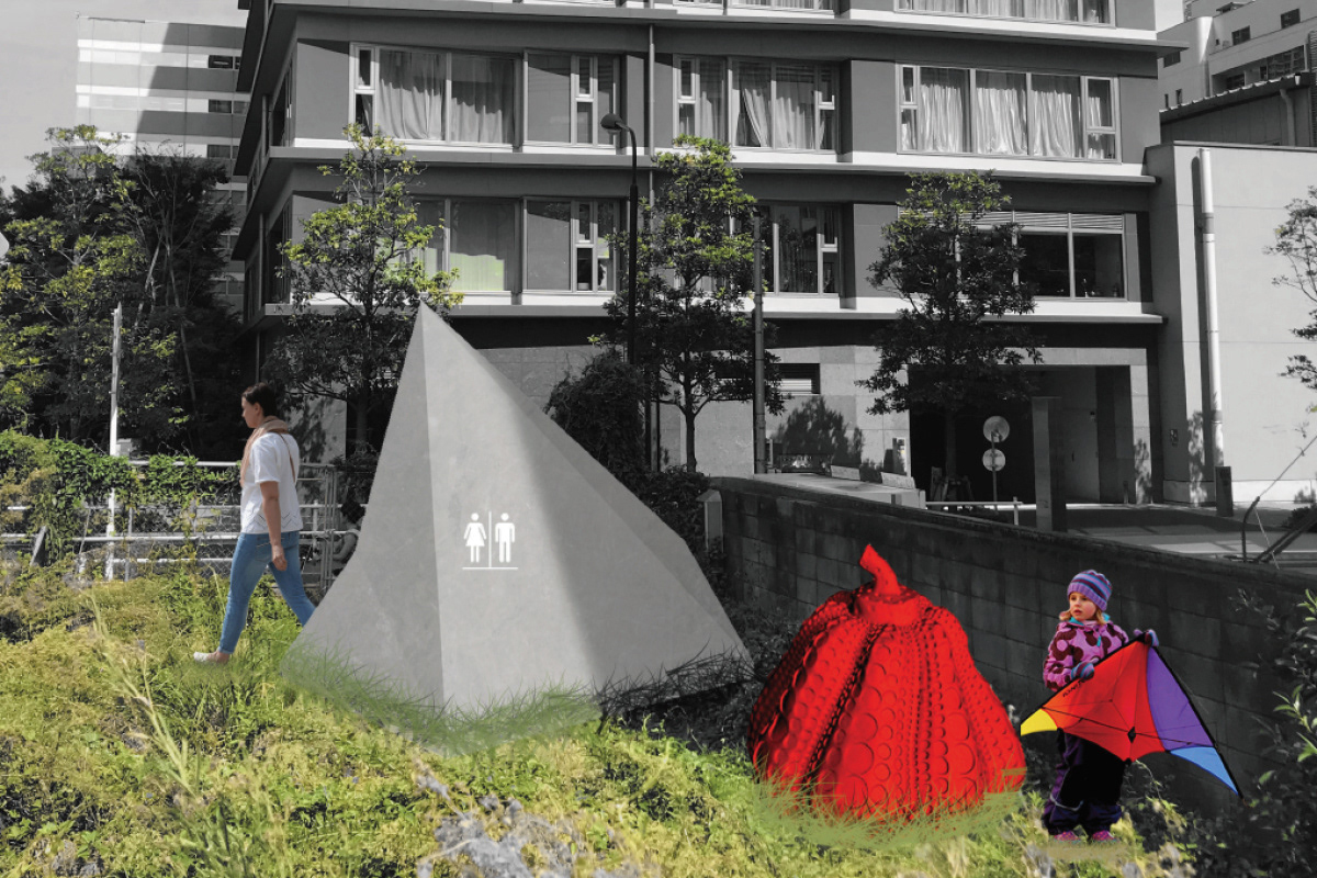
Restroom
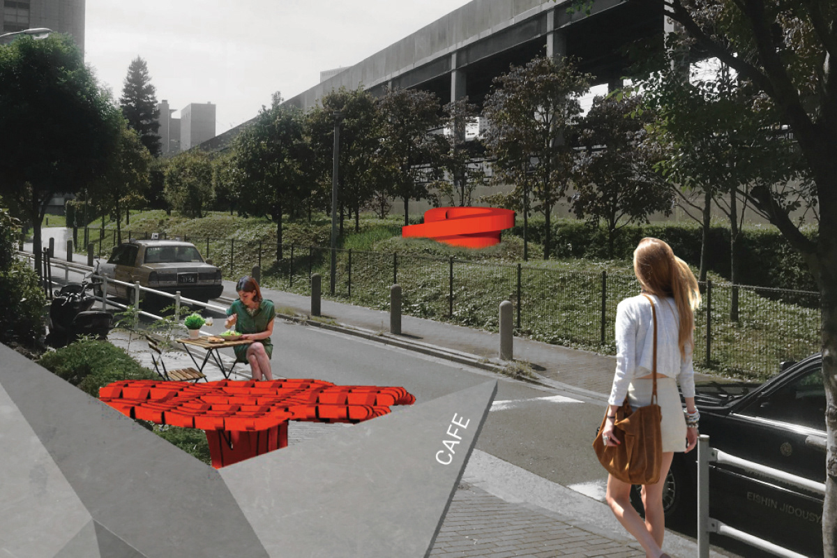
Sidewalk Cafe
Park Revitalization
Canal Restaurant